As posted on their homepage: The High Performance Wireless Research and Education Network (HPWREN), a University of California San Diego partnership project led by the San Diego Supercomputer Center and the Scripps Institution of Oceanography’s Institute of Geophysics and Planetary Physics, supports Internet-data applications in the research, education, and public safety realms.
HPWREN functions as a collaborative, Internet-connected cyber infrastructure. The project supports a high-bandwidth wireless backbone and access data network in San Diego, Riverside, and Imperial counties in areas that are typically not well-served by other technologies to reach the Internet. This includes backbone locations, typically sited on mountain tops, to connect often hard-to-reach areas in the remote Southern California back country.
- For more HPWREN information, visit their home page at http://hpwren.ucsd.edu/index.html#
- View the latest once-per-minute live camera images from HPWREN at http://hpwren.ucsd.edu/cameras/
- HPWREN time lapse and/or live stream videos are available on YouTube at https://www.youtube.com/user/hpwren/videos
- View the latest once-per-minute live camera images from /SDG&E ALERTWildFire at http://www.alertwildfire.org/sdge/?camera
- For related posts from UCCA, visit https://www.universitycitynews.org/category/sdfd/
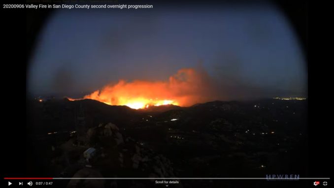
From HPWREN YouTube: This is a time lapse animation of once-per-minute data of the Valley Fire in San Diego County near Alpine and its overnight progression, as seen from a east pointing HPWREN camera on Lyons Peak. It extends from 18:00 on 6 September 2020 to 6:00 next day, and is shown at 15 frames per second, uploaded as 3072×2048 pixels.


 Please note: Information and advertising items included for publication in our print newsletter or on our websites or shared at our community meetings do not constitute an endorsement by the University City Community Association (UCCA) organization or its board members.
